")


MISSION:
Develop and field modernized intelligence systems through an exceptional workforce of dedicated professionals and integrate best value solutions for the battlefield of tomorrow.
VISION:
Provide revolutionary solutions to enable Commander’s situational understanding in the future complex environment.
DESCRIPTION:
Project Manager Intelligence Systems & Analytics (PM IS&A) is responsible for modernizing the Army’s intelligence foundation by developing and delivering advanced systems and applications. PM IS&A focuses on enhancing intelligence processing, exploitation, and dissemination (PED) capabilities to improve situational awareness for commanders across all levels and oversees a portfolio of projects designed to transform intelligence operations. Key projects include Tactical Intelligence Targeting Access Node (TITAN); Army Intel Data Platform (AIDP); Project Linchpin; Intelligence Applications; Geospatial Intelligence Modernization; Joint Tactical Terminal – Next Gen (JTT-NG), and the current force Distributed Common Ground System – Army Family of Systems (DCGS-A).
MR. GREGORY HARTMAN
Mr. Gregory Hartman began Government service in 2005 as a Computer Scientist assigned to the RDECOM CERDEC Software Engineering Directorate at Fort Monmouth, NJ. In 2009, he joined PEO IEW&S, PM DCGS-A. During this time, key assignments included leading software efforts on the DCGS-A Mobile Basic program and serving as the lead system engineer for DCGS-A Mobile Systems. In these assignments, he provided day-to-day technical leadership for the DCGS-A ACAT I AM program through its Army and OSD oversight activities leading to DAE-approved Milestone C and Full Deployment Decisions. He held this position until May 2013.
In May 2013, Mr. Hartman was selected as the Chief Engineer for PM DCGS-A, providing leadership and direction for all technical efforts across the DCGS-A portfolio. During this time, he oversaw the successful FOT&E of the ACAT I DCGS-A program, the transition of the portfolio to commercial-item centric acquisition strategies, and the initial stages of Artificial Intelligence experimentation, Cloud transition, and cybersecurity modernization across the portfolio.
In May 2019, Mr. Hartman was selected as the Deputy Project Manager for PM DCGS-A, providing overarching leadership and direction to projects assigned to the ACAT I DCGS-A portfolio. In June 2020, Mr. Hartman guided the program through its transition into Project Manager, Intelligence Systems and Analytics. In his time as Deputy PM, he has been responsible for guiding the portfolio through the initiation and development of multiple key modernization programs critical to Army modernization, while maintaining readiness and managing the lifecycle and divestment of current force systems. In January 2025, he was assigned responsibility of Project Manager, PM IS&A, responsible for total lifecycle management of all efforts across the portfolio.
Mr. Hartman earned his Bachelor Degree in Computer Science, with a Minor in Economics from the Pennsylvania State University in 2005. He earned his Master’s Degree from Monmouth University in Software Engineering in 2008. Mr. Hartman is a member of the Army Acquisition Corps and is certified at the Advanced level for Program Management and Practitioner level for Engineering & Technical Management. He completed the Army Civilian Education System Advanced Course in 2015, Executive Program Management Course in 2020, the Army / Carnegie Mellon Data-Driven Leadership certificate in 2022 and the Army Understanding the Defense Industry course through UNC in 2024.
Mr. Hartman’s civilian awards include two Commander’s Awards for Civilian Service, two Superior Civilian Service Awards, two Team C4ISR Top-10 personnel of the year awards, and the Knowlton Award for his contributions to Army Military Intelligence.
STEPHEN J. MORTON

Mr. Stephen J. Morton is the acting Deputy Project Manager (DPM) for the Project Manager Intelligence Systems & Analytics (PM IS&A). He is responsible Acquisition Planning and Execution of the Army’s next generation for Intelligence Processing, Exploitation and Dissemination capabilities. Mr. Morton joined PEO IEW&S over 20 years ago and has 40 years of experience supporting multiple Project Managers. Prior to his current assignment Mr. Morton was the Deputy Product Manager (DPdM) for Data & Analytics, DPdM for DCGS-A Increment 2, the Product Director for DCGS-A Software Development, and the DPdM for DCGS-A Intelligence Operations. In addition to his roles in PM IS&A and PM DCGS-A, Mr. Morton has been a Branch Chief for the Communications Electronics Command (CECOM) Integrated Logistics Support Center (ILSC), an Integrated Logistics Support Manager (ILSM) for several systems, a Systems Engineer, and Electronics Engineer on a variety of Intelligence and Communications programs. Mr. Morton has a BS in Industrial Engineering and is level III certified in Program Management and Systems Planning, Research, Development and Engineering.
LATEST PM IS&A NEWS
RESOURCES
PROJECT MANAGER INTELLIGENCE SYSTEMS & ANALYTICS PUBLIC AFFAIRS SPECIALIST
IS&A SUPPORT CENTER
DATA & ANALYTICS
INTELLIGENCE SYSTEMS
PROJECT LINCHPIN
INTEL ENABLERS (IE)
Joint Tactical Terminal (JTT)
Programs
DATA & ANALYTICS
Capability Drop 1 (CD-1)
MISSION:
CD-1 is a tactical, expeditionary, toolset at the battalion echelon, addressing soldier’s requirements to build All Source intelligence products with streamlined workflows greatly reducing the burden of soldier training and operations.
DESCRIPTION:
Provides the Battalion Intel Analyst with the capabilities that they need to perform their most critical tasks, in a connected or disconnected environment. Provides the 35F, All Source Analyst, the tools for performing the Intelligence Preparation of the Battlefield (IPB); Intelligence, Surveillance, and Reconnaissance (ISR) planning; Targeting; and support to the Intelligence Architecture.
SYSTEM INTERDEPENDENCIES:
- None
PROGRAM STATUS:
- 879 CD1’s fielded to 402 Maneuver Battalions as of FY21
PROJECTED ACTIVITIES:
- FY25: CD 1 Fielding to additional authorized units
- Workstation refresh & new user interface release – unified look & feel across All Source capability portfolio
Capability Drop 1 (CD-1)
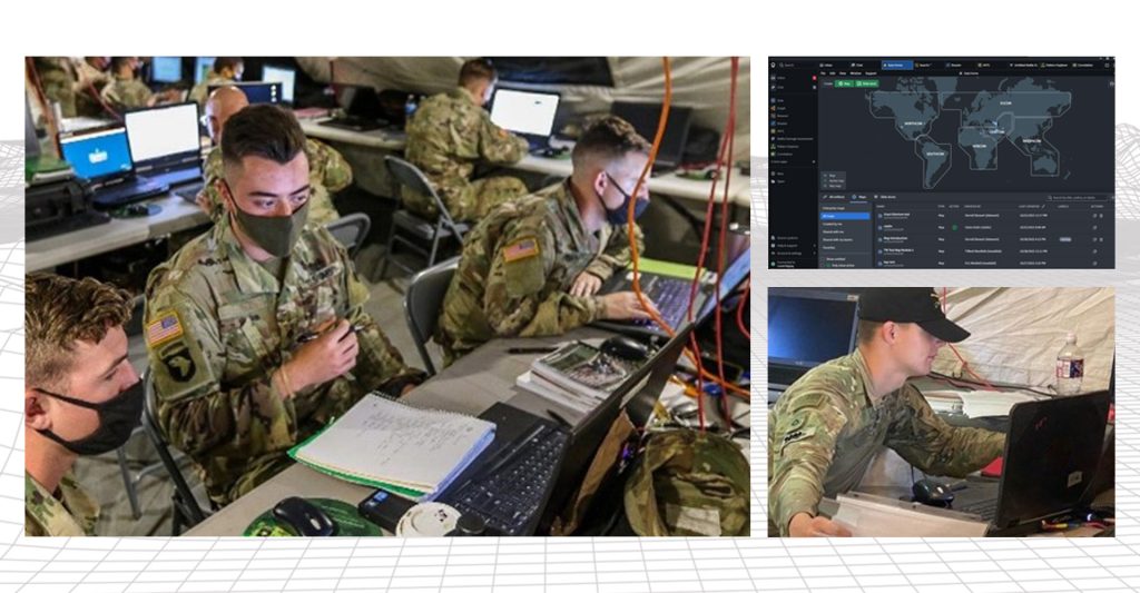
Army Intelligence Data Platform (AIDP)
MISSION:
Set the Army Intel Data foundation and modernize the Army Intel data and analytics.
DESCRIPTION:
Modernizes the core technology fielded at the Army’s Fixed Sites/Military Intelligence Brigades with a modern Enterprise Data Warehousing and Analytics solution. Major capabilities include data ingress, processing, egress, persistence, integrity, and discovery (query) and improved security and system administration. AIDP organizes Data for Analytics & Hosts Services and Tools in the Cloud that are available to users at all echelons.
SYSTEM INTERDEPENDENCIES:
- US Army Military Intelligence Commercial Cloud Service Provider (AC2SP)
PROGRAM STATUS:
- ~500 Users Trained per quarter; initial New Equipment Training and AIDP access delivered across majority of Combatant Commands
- Full Software Material Release approved in September 2024
PROJECTED ACTIVITIES:
- Continue New Equipment Training (NET) and add users across all Combatant Commands
- Provide Exercise Support and continue New Data Source Integrations
- Implement priority enhancements to AIDP
Army Intelligence Data Platform (AIDP) (formerly DCGS-A CD-2)
![]()
Intel Apps (IA)
MISSION:
Provide the modernized intelligence analysis tools to support Multi-Domain Operations.
DESCRIPTION:
Intel Apps will provide capabilities for all Intelligence disciplines across the Army. The initial set of Intel Apps includes All Source, Intelligence Support to Targeting, Information Collection Management, and Weather Operational Effects. The applications are hardware/platform agnostic and can be hosted in computing environments as required, such as in the Cloud or on an edge computing platform.
SYSTEM INTERDEPENDENCIES:
- N/A
PROGRAM STATUS:
- Limited Deployment Decision approved for All Source II and Intel Support to Targeting, limited deployment and exercise support ongoing
- Contracts awarded for Weather Operational Effects and Information Collection Management
PROJECTED ACTIVITIES:
- Continue refinement of All Source & Intel Support to Targeting capability with select Army units
- Conduct integration and testing activities on Weather Operational Effects & Information Collection Management
Intel Apps (IA)
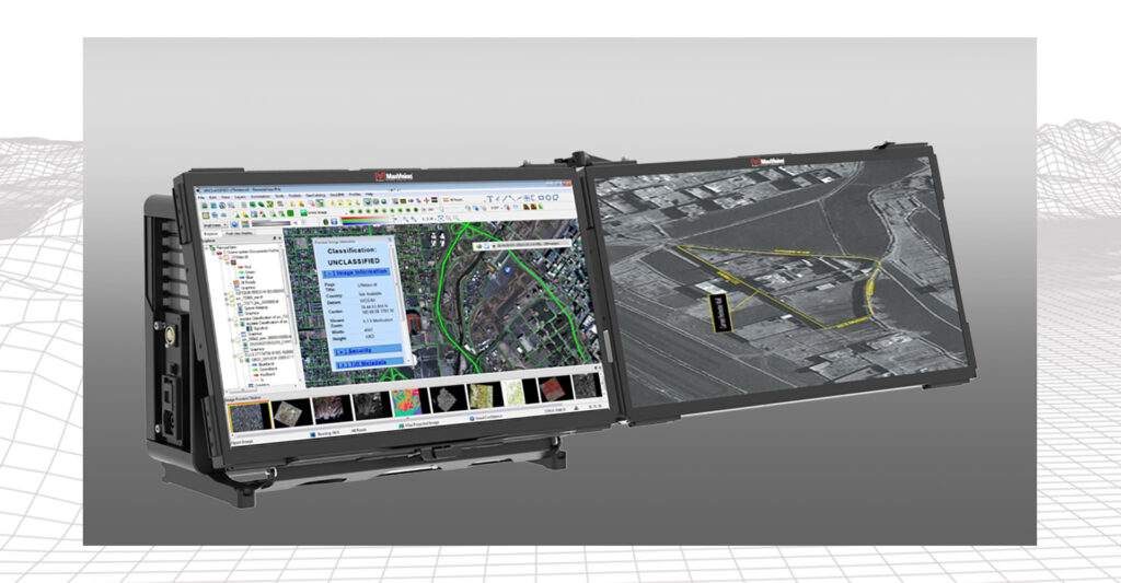
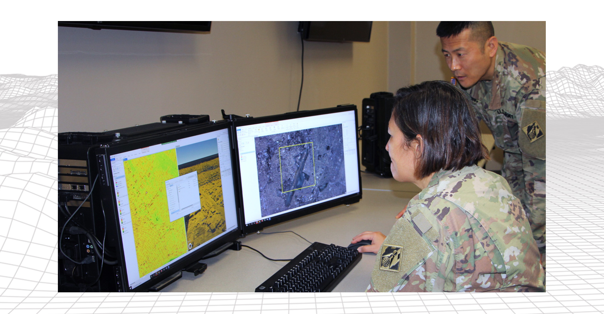
GEOINT Workstation (GWS)
MISSION:
Enable the processing, storage and dissemination of Geospatial Intelligence (GEOINT) data in support of all Warfighting Functions.
DESCRIPTION:
The NextGen GWS consists of powerful hardware combined with best of breed commercial off-the-shelf and government off-the-shelf GEOINT software that enables Geospatial Engineers (12Y) and GEOINT Imagery Analysts (35G) with the capability to produce, manage, exploit, and disseminate the Standard and Sharable Geospatial Foundation (SSGF) and authoritative GEOINT products.
SYSTEM INTERDEPENDENCIES:
- Edge Node / Tactical Server deployments to enable management and dissemination of Standard and Shareable Geospatial Foundation (SSGF) and GEOINT information
PROGRAM STATUS:
- Tech Refresh ongoing of existing GWS and Geospatial Engineer Plotter Suite (GEPS)
- Geospatial server software fielded at echelon as a component of tactical computing environment
PROJECTED ACTIVITIES:
- FY25: Delivery of updated GWS and GEPS hardware; Initiation of Next-Gen GEOINT Activities.
- Fielding of SSGF management and dissemination capabilities. Initial Capability for Army Geo Data Fabric (AGDF)
NextGen GEOINT Workstation (GWS)
INTELLIGENCE SYSTEMS
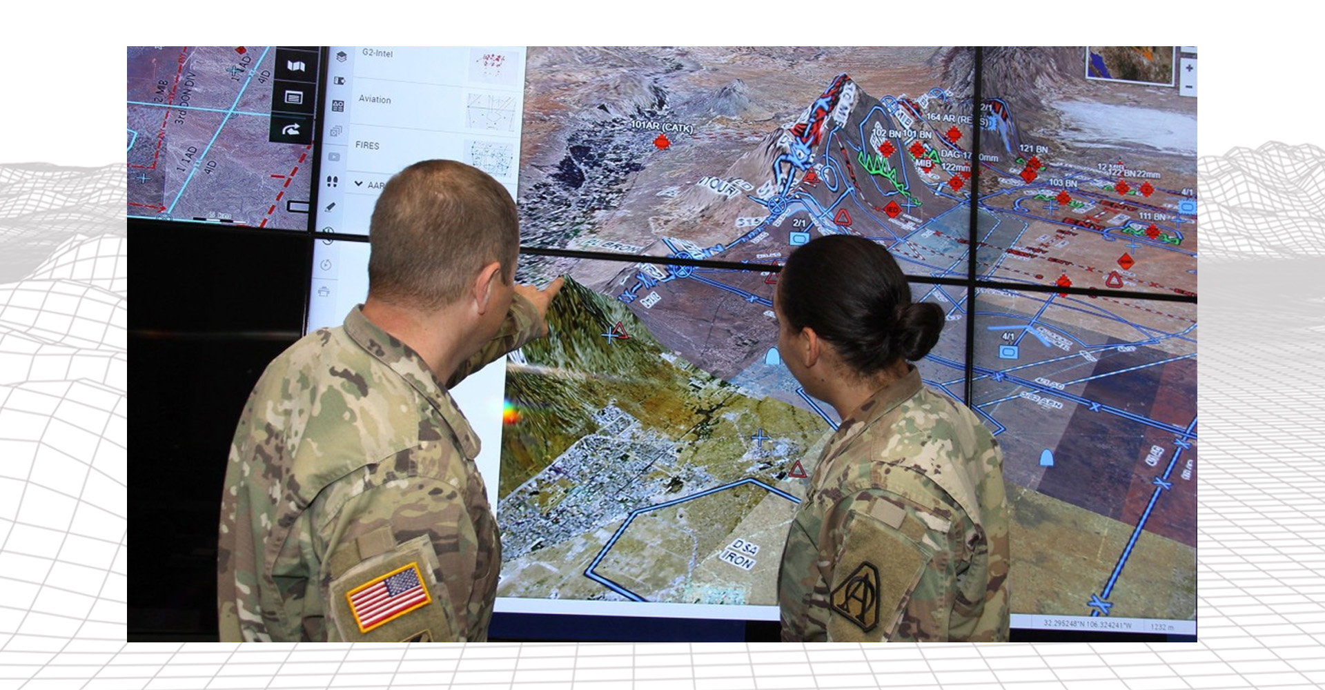
Tactical Intelligence Targeting Access Node (TITAN)
MISSION:
TITAN is a scalable and expeditionary intelligence ground station that supports commanders across the entire Joint All Domain Operations (JADO) battlefield framework with capabilities tailored by echelon. TITAN leverages Space and High Altitude, Aerial, and Terrestrial layer sensors to provide target nominations directly to fires command and control networks as well as multi-discipline intelligence support to targeting and SA/SU in support of mission command.
DESCRIPTION:
TITAN is the next-generation, Artificial intelligence (AI)-enabled, expeditionary, maneuverable intelligence ground station to support Multi-Domain Operations (MDO), Joint All-Domain Operations (JADO), and Long-Range Precision Fires (LRPF) providing Multi-Domain Deep Sensing, Analysis and Processing, Exploitation, and Dissemination (PED). TITAN will receive sensor data from Space, High Altitude, Aerial, and Terrestrial layer sensors to provide actionable targeting information directly to fires networks as well as multi-discipline intelligence support to targeting and Situational Awareness (SA)/Situational Understanding (SU) in support of mission command.
SYSTEM INTERDEPENDENCIES:
- ISR Sensors (Space, High Altitude, Aerial and Terrestrial)
- Enables the processing and dissemination of intelligence information on a multi-enclave platform
PROGRAM STATUS:
-
Middle Tier of Acquisition (MTA), Rapid Prototyping – Prototype Maturation Phase (PMP)
- February 2024: Prototype Maturation Phase OTA Awarded
- July 2024: First TITAN Advanced Prototype delivered
- March 2025: Second TITAN Advanced, First TITAN Basic Prototypes delivered
PROJECTED ACTIVITIES:
- FY25: First Unit of Issue for TITAN Advanced. First Unit of Issue for TITAN Basic. Multiple Soldier Touchpoints. Additional prototype issuances for TITAN Advanced and Basic. Test events and unit experimentation to inform transition out of MTA Rapid Prototyping.
- FY26: Deliver final TITAN prototypes. Conduct final MTA Operational Test of TITAN. Complete TITAN Rapid Prototyping program; initiate production program for TITAN. Award contract for initial production of TITAN.
Tactical Intelligence Targeting Access Node (TITAN)
PROJECT LINCHPIN
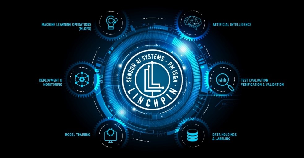
Project Linchpin
MISSION:
Project Linchpin delivers trusted Artificial Intelligence (AI) capabilities to Army programs.
DESCRIPTION:
Project Linchpin serves as the Army AI Operations and Services (AIOPs+) ecosystem for all Army Acquisition Programs implementing AI. Project Linchpin provides a baseline AI Ecosystem consisting of infrastructure, tools, services, and contracts to ensure reliable, safe, and trustworthy delivery of AI capabilities.
KEY OBJECTIVES:
- Project Linchpin is a collaboration involving Army Development Command’s (DEVCOM) – Army Research Laboratory (ARL), the Army Communications-Electronics Command’s (CECOM) Software Engineering Center (SEC), the Army Geospatial Center (AGC), and the Army Command, Control, Computers, Communications, Cyber, Intelligence, Surveillance, and Reconnaissance (C5ISR) Center, the Office of the Secretary of Defense – Chief Data and AI Office (OSD CDAO), the OSD Research & Engineering (OSD-R&E) (Trusted AI and Autonomy), the Army Futures Command’s (AFC) – AI Integration Center (AI2C), Intelligence Community partners, and growing
PROGRAM STATUS:
- Project Linchpin Investment Activity ADM signed 15 January 2025 to establish Project Linchpin as an Investment Activity that will serve as the Army AIOps+ ecosystem for all Army acquisition programs implementing AI
- AI Ecosystem through Project Linchpin Policy Memorandum signed 16 January 2025 to establish Project Linchpin as the nexus of the Assistant Secretary of the Army (Acquisition, Logistics and Technology) (ASA(ALT)) Artificial Intelligence Ecosystem by providing secure and trusted AI infrastructure and services for Army acquisition programs
- x29 Small Business Innovation Research awards since 2QFY24 valued over $40M. More topics and awards forthcoming
- x3 contracts with innovative companies supporting active pilots
- x2 contracts through Army S&T community to inform standards
- Project Linchpin current customers:
- PEO IEW&S
- PEO GCS
- PEO STRI
- Additional PEOs actively onboarding onto Project Linchpin services
PROJECTED ACTIVITIES:
- icial Intelligence and Software at Pace (AIS@P); Multi-Award Task Order Contract (MATOC) Request for Proposals in 2QFY25 with anticipated base contract awards in 4QFY25
- Contract supporting Artificial Intelligence / Machine Learning (AI/ML) for PEO IEW&S and other customers as required focusing on best of breed approach to selecting vendors at base contract level
- Contract broken down into 5 AI/ML Subpools
- Streamlined Acquisition Approach – Procurement Action Lead Time (PALT) of Task Orders <25M in 30 days
- Government describes problem and environment, and industry proposes solution
- Perpetual changing requirement pools; perpetual evaluation and onboarding/offboarding of new vendors
Upcoming SBIR opportunities (confirmed):
- xTech AI Grand Challenge (submission dates: 19 Dec 2024 – Jan 30 2025). Website: https://www.xtech.army.mil/ai-grand-challenge/
- xTechIgnite Competition (submission dates: 5 Feb 2025 – 12 Mar 2025). Website: https://www.xtech.army.mil/competition/xtechignite/
Upcoming SBIR topic releases (potential):
- Model development for EW-SIGINT
- Data Service and Labeling
- Counter-counter AI
- TORC Evaluation Harness
Project Linchpin
Intel Enablers (IE)
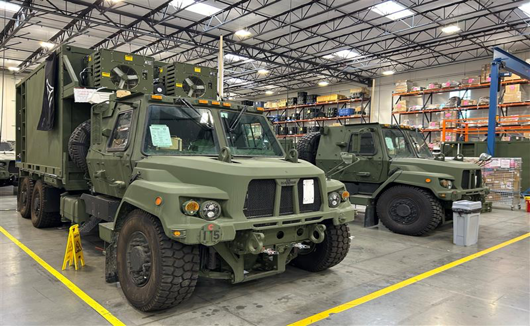
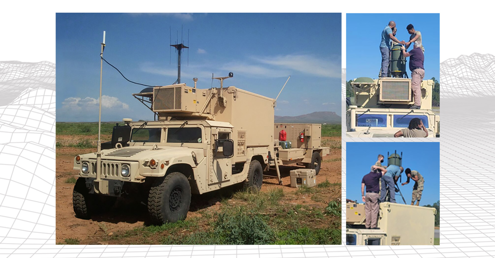
Operational Intelligence Ground Station (OGS), AN/TYQ-224B
MISSION:
OGS provides deployable Ground Station capabilities for operational Army units to receive, process, exploit and disseminate intelligence from Army, Joint and National sensors.
DESCRIPTION:
The OGS is contained in an S-280 shelter, providing services on multiple networks primarily focused on the receipt, processing, exploitation and dissemination of Geospatial and Signals Intelligence. This includes data links and capabilities for the specific processing and interface required for Army Aerial ISR Platforms, along with numerous other Army and Joint platforms. The OGS includes tactical Common Data Links for receiving data via Line-of-Sight from aerial layer assets. OGS are deployed to Army Corps and Aerial Exploitation Battalions.
SYSTEM INTERDEPENDENCIES:
- EMARSS and Guardrail aircraft sensors, Satellite communications
PROGRAM STATUS:
- Operations and Sustainment
PROJECTED ACTIVITIES:
- Delivery of final OGS hardware and software upgrades to provide required operational capability.
Operational Intelligence Ground Station (OGS), AN/TYQ-224B
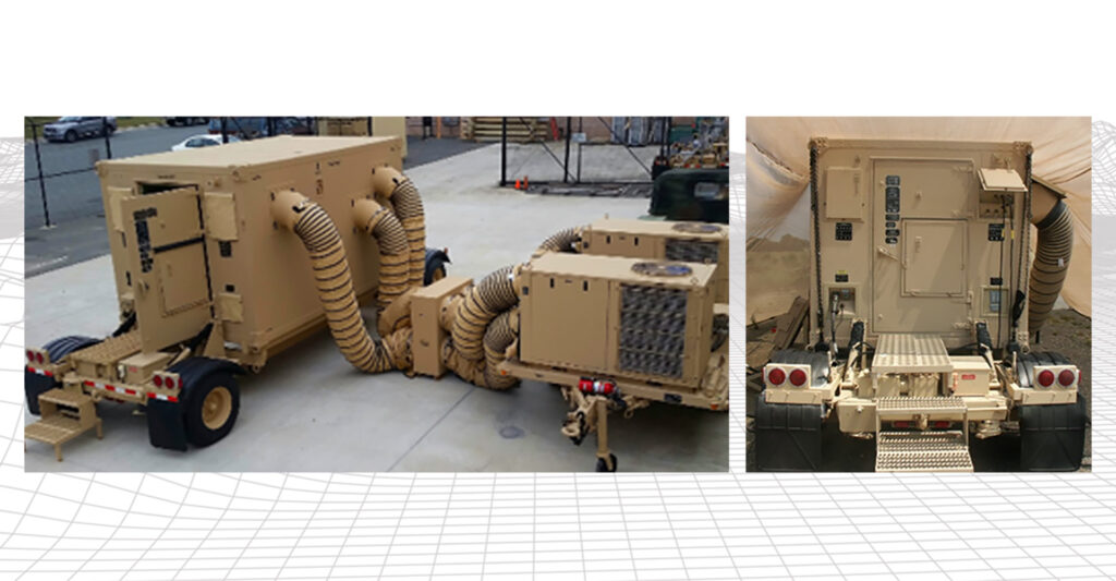
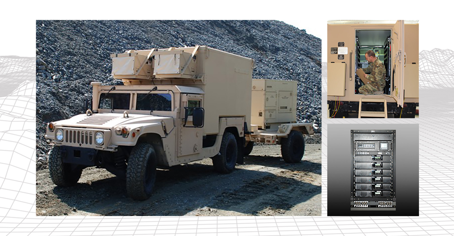
Tactical Intelligence Ground Station (TGS)
MISSION:
Receive, correlate, process, store and display actionable GEOINT Data supporting Indications and Warnings; Target Acquisition, and Processing, Exploitation and Dissemination (PED) at the tactical level.
DESCRIPTION:
Enables BCT, Division and Corps units to receive, correlate, process, store and display actionable GEOINT Data supporting Indications and Warnings and Target Acquisition at the tactical level. The TGS supports Processing, Exploitation and Dissemination (PED) execution to answer the maneuver Commander’s priority intelligence requirements and support their decision-making process in the conduct of operations. Provides links to multiple Army and Joint sensors enabling near-real time intelligence processing, exploitation, and dissemination.
SYSTEM INTERDEPENDENCIES:
- Connects to Army and Joint aerial sensors; leverages Army radios for communications
PROGRAM STATUS:
- Operations and Sustainment
PROJECTED ACTIVITIES:
- FY25 – Technical refresh of TGS Lot D & E systems and fielding to priority Army units.
Tactical Intelligence Ground Station (TGS)
Cross Domain Server Set (CDSS)
MISSION:
The CDSS allows analysts to transfer data, information and products across networks operating at different security levels.
DESCRIPTION:
The CDSS supports Army Commanders and Intelligence Analysts across the full range of military operations by transferring information between multiple networks operating at different classification levels, enabling secure and timely transfer of critical data to the point of need.
SYSTEM INTERDEPENDENCIES:
- Dependent on sending and receiving systems at appropriate classification levels
PROGRAM STATUS:
- Operations and Sustainment
PROJECTED ACTIVITIES:
- FY25 – Deployment of modernized CDSS configuration to priority Army units
Cross Domain Server Set (CDSS)
Cross-Domain Enterprise All-source User Repository (CENTAUR)
MISSION:
CENTAUR provides multi-directional, cross-domain search and retrieval and supports direct transfer of structured, unstructured, and streaming data.
DESCRIPTION:
CENTAUR provides two-way, dynamic content discovery and retrieval with integrated coalition sharing capability. It provides an Enterprise capability for machine-to-machine, cross-domain information sharing between different security domains for a variety of data, as well as repeatable process for automated cross-domain data sharing.
SYSTEM INTERDEPENDENCIES:
- CENTAUR uses the Cross Domain Federation Service (CDFS), incorporates DIB for cross domain two-way, dynamic content discovery and retrieval with integrated coalition sharing capability
PROGRAM STATUS:
- Operations and Sustainment
PROJECTED ACTIVITIES:
- Continued operations of CENTAUR capability
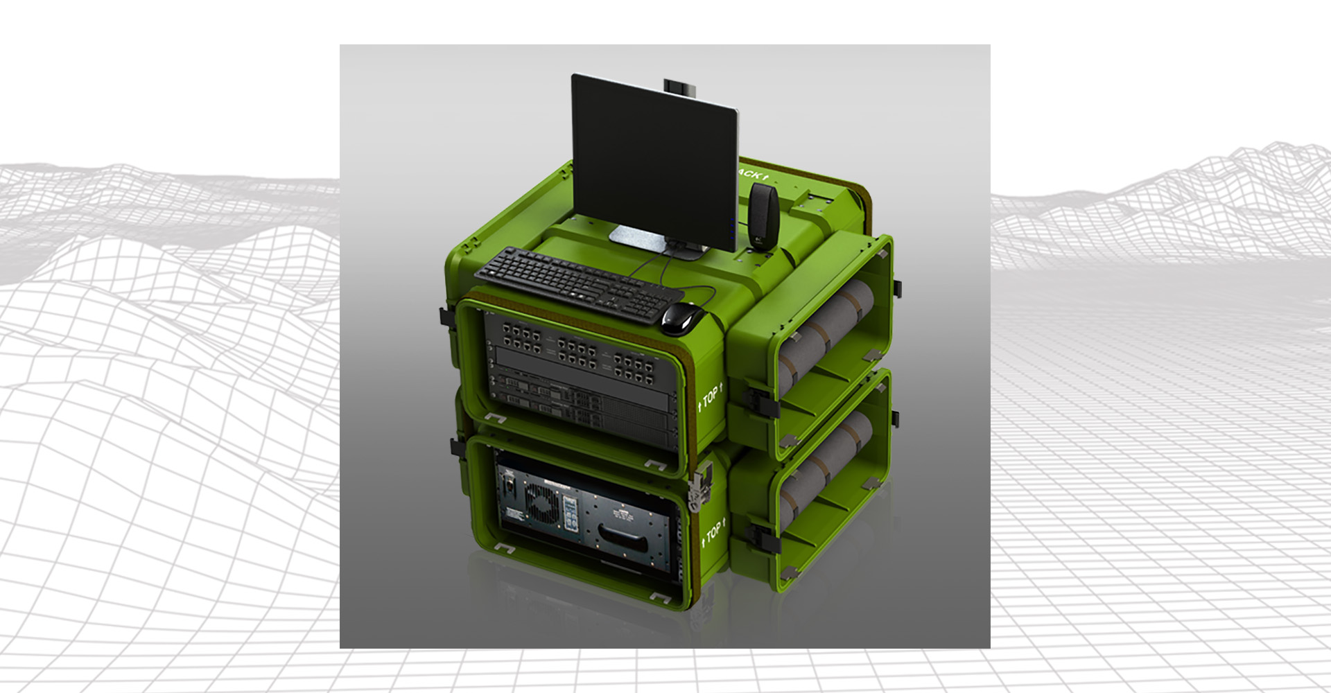
Intelligence Fusion Server (IFS)
MISSION:
Provide a suite of core Processing, Exploitation and Dissemination (PED) Applications for Intelligence Analysis and storage for tactical and organizational formations with the capability to maintain multi-intelligence level databases, threat situational awareness and Standard Shareable Geospatial Foundation services.
DESCRIPTION:
The IFS is a transit-cased tactical computing platform which delivers Processing, Exploitation and Dissemination services and storage to support multi-domain intelligence, geospatial, civil affairs, space operations and special operations in a full spectrum environment. The IFS provides services to users at maneuver, maneuver support and sustainment organizations at the Brigade, Divisions, Corps and Echelon Above Corps levels on multiple security networks.
SYSTEM INTERDEPENDENCIES:
- N/A
PROGRAM STATUS:
- Operations and Sustainment
PROJECTED ACTIVITIES:
- Continued support to Army operations
Intelligence Fusion Server (IFS)
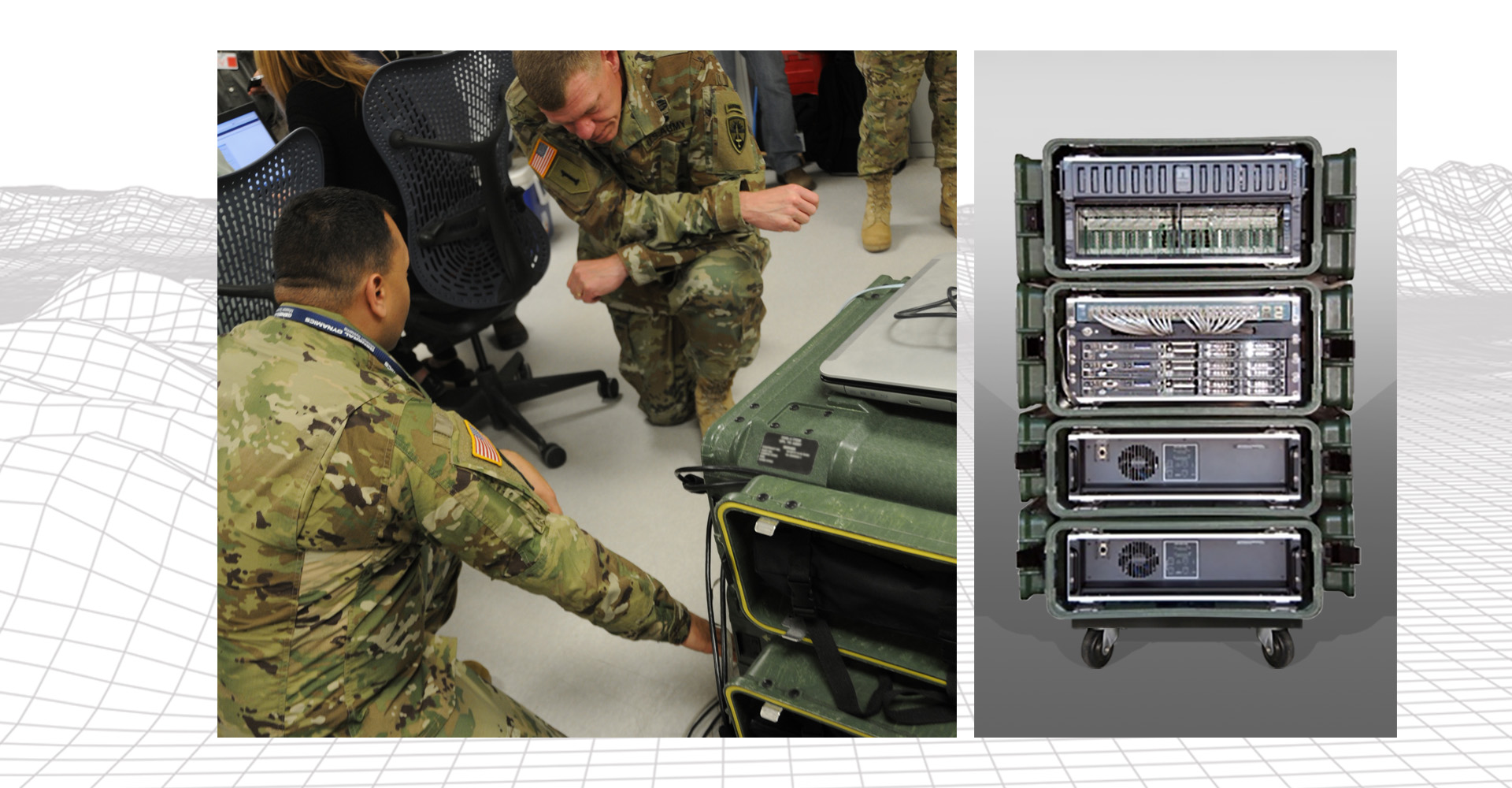
Intelligence Processing Center (IPC-v2)
MISSION:
The IPCv2 is a tactically deployable, self-contained, fully integrated system capable of delivering a full range of intelligence Processing, Exploitation and Dissemination capabilities to expeditionary Army units.
DESCRIPTION:
The Intelligence Processing Center 2 (IPC-2) is the BCT, DIV, and CORPS Commanders’ primary Intelligence, Surveillance, and Reconnaissance (ISR) management networking and analytical support system. It is a deployable, fully integrated system capable of information processing, networking, and communications. The IPCv2 operates within the BCT main Tactical Operations Center (TOC) and DIV/Corps Tactical Command Post (TAC CP). With its ability to operate on three different networks, the IPCv2 provides faster setup and tear-down times and reduces the noise, cooling, and the footprint inside the Command Post and TAC CP.
SYSTEM INTERDEPENDENCIES:
- N/A
PROGRAM STATUS:
- Operations and Sustainment
PROJECTED ACTIVITIES:
- Continued operation and sustainment activities
Intelligence Processing Center (IPC-v2)
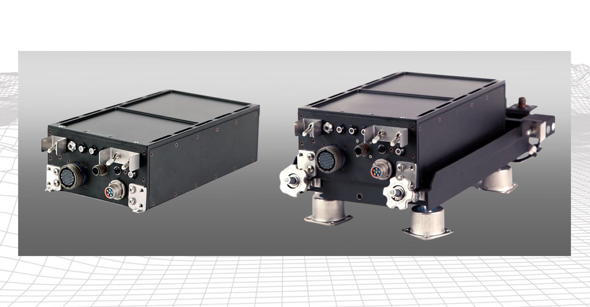
Joint Tactical Terminal (JTT)
Joint Tactical Terminal (JTT)
MISSION:
Provides Warfighter access to tactical intelligence information via the Joint Integrated Broadcast Service (IBS) enterprise, by securely disseminating critical battlespace awareness data globally in near real-time (NRT) to commanders, planners and Warfighters.
DESCRIPTION:
Joint Tactical Terminal variants (JTT-Senior, JTT-IBS and JTT- Next Generation) are the primary radio terminal component of the IBS. The JTT is a SATCOM terminal that satisfies radio communications requirements for the IBS program. JTT provides various Joint Intel producers, consumers, and weapon systems global access to IBS message priorities to include Sensor-to-Sensor and Sensor-to-Shooter data exchange, Indications & Warnings, ISR common picture, Targeting, Friendly Forces Tracking and Combat Search and Rescue data.
SYSTEM INTERDEPENDENCIES:
- Radio terminal for the Integrated Broadcast Service enterprise
PROGRAM STATUS:
- Operations and Sustainment (JTT-IBS / JTT-Senior)
- Limited Production and Customer Procurement (JTT-NG)
PROJECTED ACTIVITIES:
- FY25:
- Block 1
- Completion of Testing and Certification activities
- Initial customer production deliveries
- Customer ordering of JTT-NG
- Block 2
- Solider Touchpoints
- External Testing and Certification for Block 2 modernization efforts
- Block 1